Meghauli
Meghauli (Nepali : मेघौली) is a village and former Village Development Committee that is now part of Bharatpur Metropolitan City in Bagmati Province of central Nepal.
In December 2014, Meghauli among neighboring other Village Development Committees was merged to form Narayani Municipality. In 2016 Narayani Municipality was itself merged into Bharatpur creating the metropolitan city of Bharatpur. The former Meghauli V.D.C. looks after civic affairs in the town. The municipal area is divided into two wards of Bharatpur Metropolitan City, Ward No. 27 & 28.
At the time of the 1991 Nepal census it had a population of 12,281 people living in 2027 individual households.
Meghauli village touches over 25 km of the borders of the park and is situated on the banks of the Rapti and Narayani River. Situated at 172 km from Kathmandu, Meghauli is in the western part of Chitwan district. Meghauli is one of the richest villages in Chitwan in terms of wildlife, different cultures and sports is located in the adjacent of Chitwan National Park.
Meghauli is the western entrance of the Chitwan National Park that attracts thousands of visitors every year to explore its rich flora and fauna. The huge 25 km long community forest is another eye catching object of Meghauli.
The new concept had been materialized for the tourism development in Meghauli. National park entrance gate, elephant stable, view tower, eco park. National crocodile dreediy pond and medicinal herbal farming in the buffer zone are the main attractions in the Meghauli.
It is also a very interesting place to learn about the local indigenous Tharu people as the village is a very well preserve example of a traditional settlement and now is possible to stay at one of the 5 Tharu Homestays.
Apart from these, Meghauli has excellent potential for the establishment of resorts and hotels. Rhino Resort, Golaghat Wildlife Resort, Barahi Resort, Chital lodge, Chautari lodge, Ecopark Volunteering and restaurant etc. are serving to some extent who come to visit Megauli.
Rafters, after a trip end at the Golaghat, the confluence of Narayani and Rapti River, can see the sunset and a view of the Himalayas. Meghauli has a good balance between human settlement and wildlife.
There is bird watching for Bengal florican, giant horn bill, lesser florican, black stork and white stork. One can also see one horned rhinos, royal Bengal tiger, chital, hog deer, barking deer, sloth bear, palm civet, langur monkey and the gharial crocodile along with many other common species such as gaur, elephant, hyena, pangolin, Gangetic dolphin, monitor lizard, and striped python. The village has a wide area for sporting activities. Every year sports like para jumping and elephant polo are held in Meghauli. One can also see the local Tharu stick dance, tiger dance and mask dance ghost dance which are popular in this village.
Map - Meghauli
Map


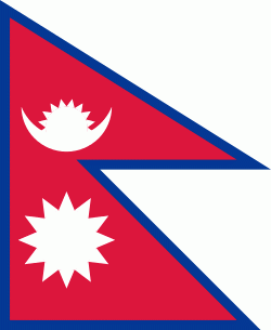
Country - Nepal
 |
 |
| Flag of Nepal | |
The name "Nepal" is first recorded in texts from the Vedic period of the Indian subcontinent, the era in ancient Nepal when Hinduism was founded, the predominant religion of the country. In the middle of the first millennium BC, Gautama Buddha, the founder of Buddhism, was born in Lumbini in southern Nepal. Parts of northern Nepal were intertwined with the culture of Tibet. The centrally located Kathmandu Valley is intertwined with the culture of Indo-Aryans, and was the seat of the prosperous Newar confederacy known as Nepal Mandala. The Himalayan branch of the ancient Silk Road was dominated by the valley's traders. The cosmopolitan region developed distinct traditional art and architecture. By the 18th century, the Gorkha Kingdom achieved the unification of Nepal. The Shah dynasty established the Kingdom of Nepal and later formed an alliance with the British Empire, under its Rana dynasty of premiers. The country was never colonised but served as a buffer state between Imperial China and British India. Parliamentary democracy was introduced in 1951 but was twice suspended by Nepalese monarchs, in 1960 and 2005. The Nepalese Civil War in the 1990s and early 2000s resulted in the establishment of a secular republic in 2008, ending the world's last Hindu monarchy.
Currency / Language
| ISO | Currency | Symbol | Significant figures |
|---|---|---|---|
| NPR | Nepalese rupee | ₨ | 2 |
| ISO | Language |
|---|---|
| EN | English language |
| NE | Nepali language |